Eastern Railway Deviation

Description
The construction of state railways in Western Australia during the late 19th century opened up large areas for settlement that previously were uninhabitable due to th solation and the
difficulties settlers encountered either obtaining supplies or getting their produce to markets.
In 1881, the first stage of what became known as the Eastern Railway was complet The line ran between Fremantle (on the coast) and Guildford (east of Pert onstruction of Stage 2, which
extended the line to Chidlow's Well (now Chidlow), when completed in 1884. Stage 3, which stretched from Chidlow's Well to York, was completed in 1885. The discovery of gold at
Kalgoorlie in 1883 provided impetus to extend the rail line further east, reaching Kalgoorlie and the associated gold fields in1897.
A section of Stage 2, travelling down the Darling Range escarpment east of Midla unction (now Midland), included a number of unfavourable curves and steep grad hich became a problem as loads became heavier. One section in particular, between Midland Junction and Lion Mill (now Mount Helena), was of great concern. A segment of the track near Boya, which had a steep 1:38 gradient coupled with a sharp curve became known to railway employees as 'Cape Horn'. The track became even more dangerous as heavier cargoes from the expanding eastern agricultural areas were shipped to Perth and the port of Fremantle, leading to some serious derailments.
The ‘Eastern Railway Deviation’ (originally known as the 'Mahogany Creek Deviation'), opened in 1896, bypassed this difficult section of line. The 12 mile (19 km) deviation ran through an
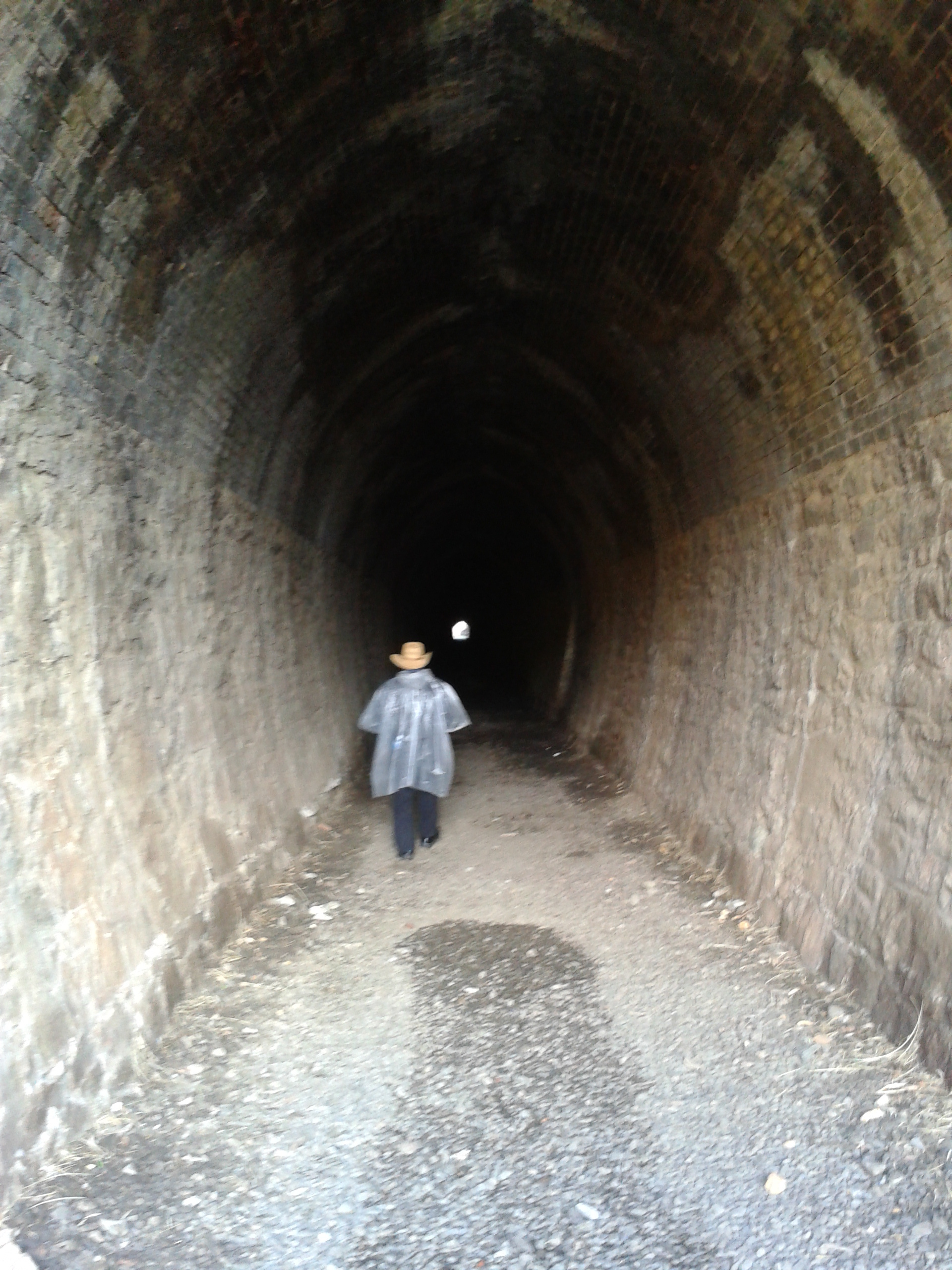
undeveloped section of the Darling Range escarpment, following a creek-line that was then thought to be the Mahogany Creek feeding down from higher up in the Range. In fact, the creek-line belongs to the Jane Brook. The deviation allowed gradients to be kept below 1:50 and eliminated sharp curves. However, it required a granite ridge to be traversed. This was achieved by the construction of a 1089 ft (332 m) long tunnel through the ridge, known as the Swan View Tunnel, using dynamite and entirely manual labour.
The Eastern Railway Deviation was a significant technical feat for the time, particularly in the construction of the tunnel. Moreover, the line enabled major commercial and social development by
opening up the Jane Brook valley for timber-cutting, quarrying and farming, the development of associated communities and towns, and the preservation of a major public natural resource in the
form of John Forrest National Park.
This nomination focuses on the section contained within the John Forrest National Park, with the engineering of the tunnel as its centrepiece.
THERE WILL BE NO CEREMONY FOR THIS SITE AT THE REQUEST OF THE OWNER HOWEVER A MARKER HAS BEEN ERECTED.
Division
Marker Type
- EHM: Engineering Heritage Marker (from 2009)